
In recent years, dronegraphy has evolved from a niche hobby into a powerful tool that is reshaping industries worldwide. By combining unmanned aerial vehicles (UAVs) with advanced camera technologies, dronegraphy enables breathtaking aerial perspectives, real-time surveillance, and innovative business solutions. As technology advances, drone photography and videography continue to redefine creativity, accessibility, and commercial value across multiple sectors.
What is Dronegraphy?
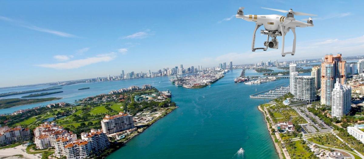
Dronegraphy refers to the art and science of capturing images and videos using drones equipped with high-definition cameras. Unlike traditional photography methods that rely on ground-level perspectives, aerial photography and drone services, drones soar into the sky to capture expansive views, cinematic angles, and dynamic shots that were once only possible with helicopters or cranes.
Modern drones integrate features like 4K/8K resolution, gimbal stabilization, obstacle detection, GPS mapping, and AI-assisted flight modes, allowing both professionals and hobbyists to achieve flawless results.
The Rise of Dronegraphy in Modern Industries
1. Real Estate and Architecture
In the real estate market, aerial photography is a game changer. Dronegraphy showcases properties from above, highlighting landscapes, neighborhoods, and architectural details that standard photography cannot capture. Developers, architects, and real estate agents use drone imagery to provide virtual tours, aerial surveys, and immersive marketing campaigns, giving potential buyers a complete perspective before visiting a property.
2. Cinematography and Media Production
Hollywood blockbusters, documentaries, and even small-scale YouTube creators now rely on dronegraphy for cinematic shots. Drones allow sweeping landscapes, dramatic chase scenes, and overhead pans that enrich storytelling. With lightweight drones capable of flying indoors and through tight spaces, filmmakers have unlimited creative freedom.
3. Agriculture and Farming
Dronegraphy is now a cornerstone of precision agriculture. Farmers use drones for crop monitoring, soil analysis, irrigation mapping, and pest detection. By analyzing aerial images, they can maximize yields, reduce costs, and ensure sustainable farming practices.
4. Construction and Infrastructure
Construction firms employ dronegraphy to track progress, inspect high-risk structures, and perform 3D mapping. Engineers benefit from real-time visuals of construction sites, saving both time and labor costs while improving safety compliance.
5. Travel, Tourism, and Hospitality
Tourism boards and resorts leverage dronegraphy to showcase destinations in an engaging way. Stunning aerial views of beaches, mountains, and cultural landmarks draw tourists and enhance marketing strategies.
6. Security and Disaster Management
Drones equipped with thermal imaging cameras play a crucial role in search-and-rescue missions, wildfire monitoring, and disaster response. Governments and organizations deploy drones for real-time surveillance, helping authorities manage emergencies effectively.
Benefits of Dronegraphy
Unparalleled Aerial Perspectives
Dronegraphy provides unique vantage points that traditional cameras cannot achieve. Sweeping panoramas and bird’s-eye views offer a dramatic and immersive experience.
Cost-Effective Solutions
Previously, aerial photography required helicopters or planes—an expensive endeavor. Drones now make it possible to achieve the same results at a fraction of the cost.
Enhanced Creativity and Storytelling
By combining movement, angles, and aerial dynamics, dronegraphy enhances the emotional impact of visuals. From wedding videography to corporate advertising, drones open new creative possibilities.
Improved Safety
Dronegraphy eliminates risks associated with manual inspections of high-rise buildings, towers, and hazardous environments. Operators can conduct safe and remote inspections without endangering workers.
Data-Driven Insights
Beyond photography, drones collect geospatial data that is critical for industries such as agriculture, construction, and urban planning. Drone imagery transforms into actionable insights through AI and data analytics.
Essential Dronegraphy Equipment
To excel in dronegraphy, having the right tools is crucial. Below are the essentials:
-
High-Resolution Camera Drones: Popular models include DJI Mavic 3, Autel EVO II, and Skydio drones.
-
Gimbal Stabilization Systems: Ensure smooth, cinematic footage even in windy conditions.
-
Extra Batteries and Propellers: For extended flight sessions and uninterrupted shooting.
-
ND Filters: Improve exposure in bright conditions, allowing for cinematic motion blur.
-
Drone Backpacks and Cases: Provide portability and protection during travel.
-
Drone Editing Software: Tools like Adobe Premiere Pro, Final Cut Pro, and DaVinci Resolve for post-production enhancement.
Dronegraphy Techniques for Professional Results
1. Mastering Camera Settings
Adjust shutter speed, ISO, and aperture to achieve professional-grade shots. Shooting in RAW format provides flexibility for post-processing.
2. Utilizing Intelligent Flight Modes
Modern drones feature modes like Follow Me, Waypoints, Orbit, and ActiveTrack, enabling smooth automated shots that reduce manual piloting errors.
3. Planning Your Flight Path
Pre-planned routes ensure smooth cinematic sequences and optimize battery usage. Tools like Google Earth or drone apps help map the best angles and lighting conditions.
4. Golden Hour Shooting
Capturing aerial images during sunrise or sunset enhances visuals with soft light, rich colors, and dramatic shadows.
5. Incorporating Motion
Dynamic shots—such as tracking a moving subject or revealing a scene through a forward tilt—add cinematic depth to drone footage.
Legal and Safety Considerations in Dronegraphy
As drone usage increases, so do regulations. Every drone operator must comply with aviation authority guidelines to ensure safe and lawful flights.
-
Drone Registration: Many countries require registering drones above a certain weight.
-
No-Fly Zones: Airports, military bases, and government areas are restricted zones.
-
Altitude Restrictions: Operators must maintain legal altitude limits (usually 400 ft/120 m).
-
Line of Sight (LOS): Pilots must keep drones within visible range.
-
Drone Insurance: Essential for commercial operators to cover liability and damages.
Ignoring these rules can result in fines, confiscation, or legal action.
The Future of Dronegraphy
The future of dronegraphy is incredibly promising. With the integration of AI, 5G connectivity, and autonomous flight systems, drones will become smarter, faster, and more efficient. Advancements in LiDAR technology will further enhance 3D mapping and modeling, while compact designs will make drones more portable.
As businesses adopt drone solutions, middle east production expect to see dronegraphy playing a larger role in smart cities, environmental monitoring, delivery systems, and space exploration.
Conclusion
Dronegraphy is more than just a trend—it is a revolutionary force reshaping industries, creativity, and how we interact with the world around us. Whether in real estate, media production, agriculture, or disaster management, drones empower us with unmatched perspectives, cost-efficiency, and data-driven insights. As technology continues to evolve, dronegraphy will remain at the forefront of innovation, offering limitless opportunities for businesses and individuals alike.